

On the first day of a recent road trip to view wildflowers in the Southern California desert, not counting an initial travel day, I visited the North Algodones Dunes Wilderness. Because I spent less time there than I’d planned, I had time in the afternoon to make a visit in the heart of Anza-Borrego Desert State Park along CA-78 and do two short hikes. This post describes the first hike, along a self-guided nature trail called Narrows Earth Trail.
On my way to the park from Algodones Dunes I noted some apricot mallow (Sphaeralcea ambigua) along the road side. A bit later I drove past my two-night home base in Ocotillo Wells, just outside the state park. As it turns out, there is a small airport owned and managed by San Diego County, the Ocotillo Airport. It is located on an old lake bed, which is naturally very flat, and has two unpaved runways used only by very small aircraft. The previous day there had been a rain storm, turning the usually-dry lake bed into an actual, though shallow, lake. This picture shows the reflection of a hill in the airport-lake. The hill is in the adjacent Ocotillo Wells State Vehicular Recreation Area. If you click on the picture to enlarge it, you should be able to see an orange wind sock next to the runways. Although I expect that the airport floods after every substantial rain storm, I’ve been there several times and not seen it like this, so it was a bit of a novelty.
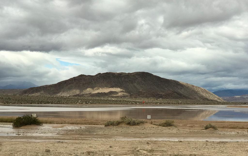
Ocotillo Airport after a rain storm
After passing the airport I continued driving west on CA-78 for several more miles, entering the park shortly after the airport. For a mile or so, the highway passes close to San Felipe Creek/Wash in a relatively narrow space between Yaqui Ridge and the Vallecito Mountains. I think this area is known as The Narrows, and the Narrows Earth Trail is in the western part of this area, about 4 miles west of Borrego Springs Rd. A parking area is on the south side of the highway near mile 81.5.
Before I found the correct parking area I pulled off the road a couple of times to check my park map. One of those places may have been at Nude Wash. In any case, I had a preview of a couple of wildflowers I would see more of, later, on Narrows Earth Trail. One was desert dandelion (Malacothrix glabrata), which is widespread and common in dry areas of San Diego, Riverside, San Bernadino, Inyo, Kern, and Los Angeles Counties.
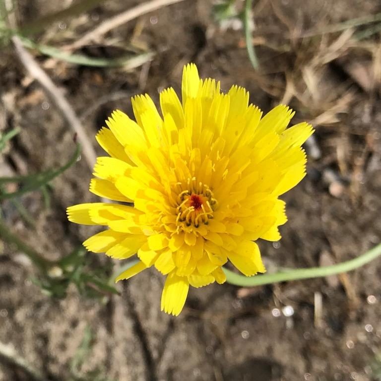
Desert dandelion
Another was Fremont pincushion (Chaenactis fremontii), found across a similar swath of Southern California. These two plants are frequently found together, as shown in the banner picture for this post.
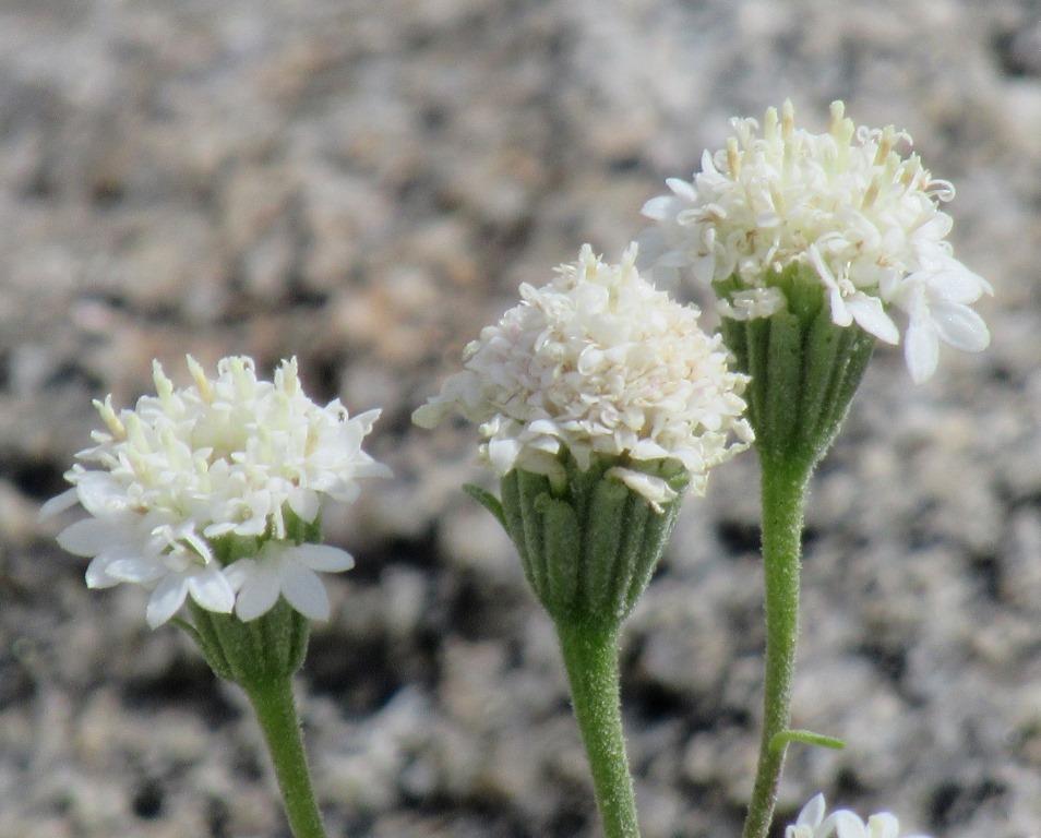
Fremont pincushion
Once I found the correct parking area I was ready to begin my short hike. This Google Earth overview shows both the Narrows Earth Trail and the Quartz Vein Wash, which I explored right afterward. A sign at the parking area directs visitors to the left, parallel to the highway, for a very short distance to the beginning of the trail. My hike was just over 0.6 mile, with a slightly different return path along the wash, which is called Powder Dump Wash, named by road-building crews in the 1930’s.

GPS track
The elevation profile is almost not worth showing, since the elevation gain and loss were only about 70 feet. As is the case for many washes that go into a hilly area, the outbound section was (slightly) uphill, with the return (slightly) downhill.
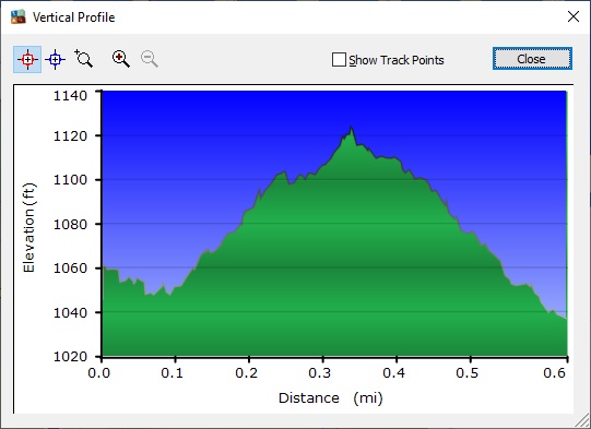
Elevation profile
There are 7 numbered posts along the trail, and a small brochure available online or in the park Visitor Center describes what you see at each post. This nature trail focuses on geology, which is often tricky to photograph although the feature of interest can be quite clear when looking at it live. I stopped at each post, though I only show the feature in a couple of cases below.
After a short distance I came to a very nice chuparosa (Justicia californica) shrub in bloom. Chuparosa is mainly found in San Diego and Riverside Counties. It’s somewhat tricky to photograph since, if there are blossoms at all, there are typically lots of them with only a few actually in focus. It is thought that the name chuparosa comes from the Mexican Spanish word chuparrosa (note slightly different spelling), which means hummingbird. In some areas of its range, chuparosa is an important food source for hummingbirds during their migration.
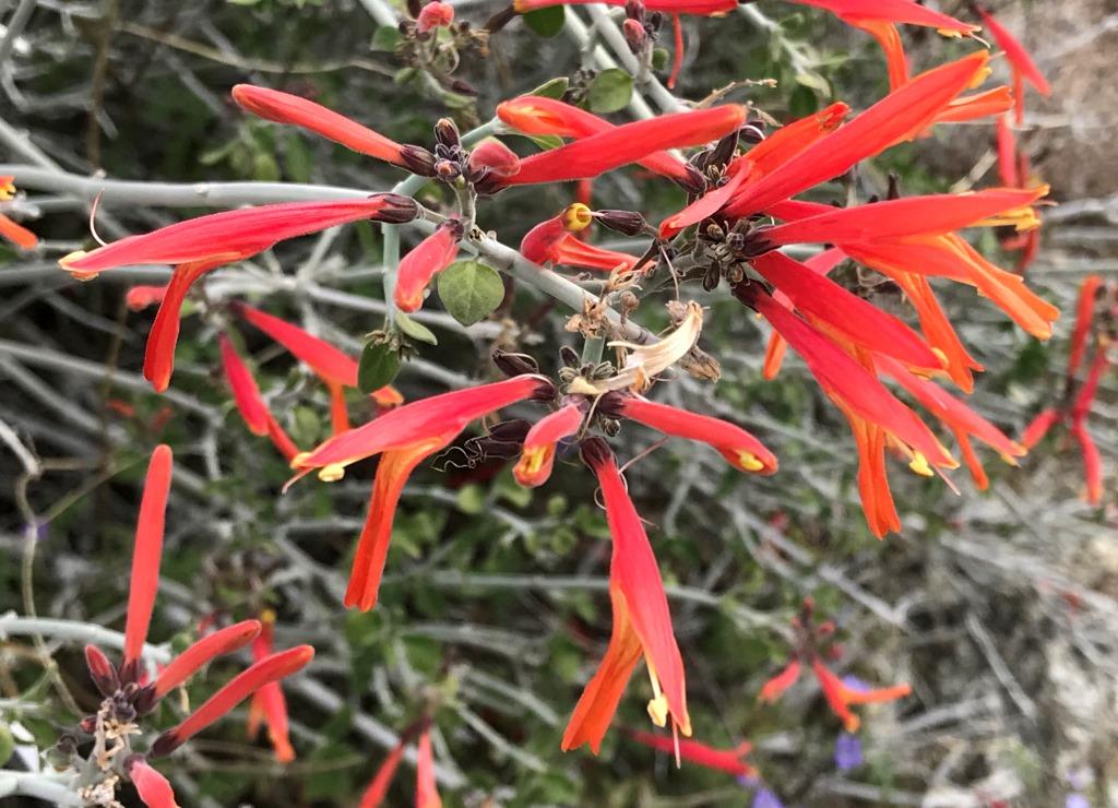
Chuparosa
Soon after that I found my first barrel cactus (Ferocactus cylindraceus), or desert barrel cactus, the small one on the left in this image. I found the slightly larger one on the right a bit later. Some barrel cacti grow to a height of several feet, and they are often found some distance away from trails. These were right next to the trail. Within California barrel cacti are mainly found in San Diego, Riverside, and San Bernadino Counties.
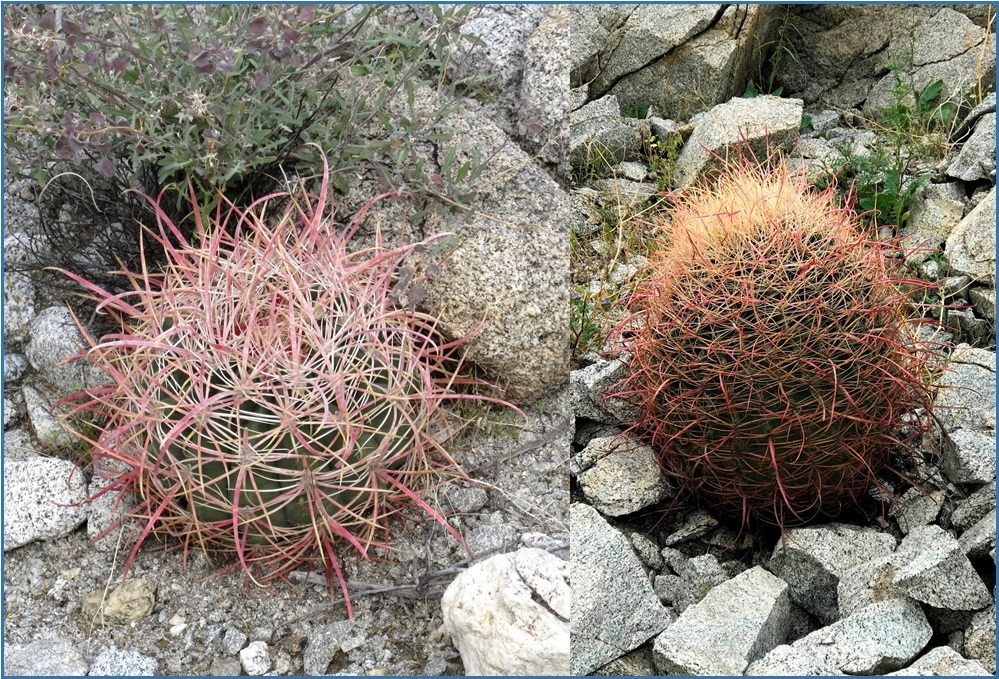
Barrel cacti: a small one (left) and slightly larger one (right)
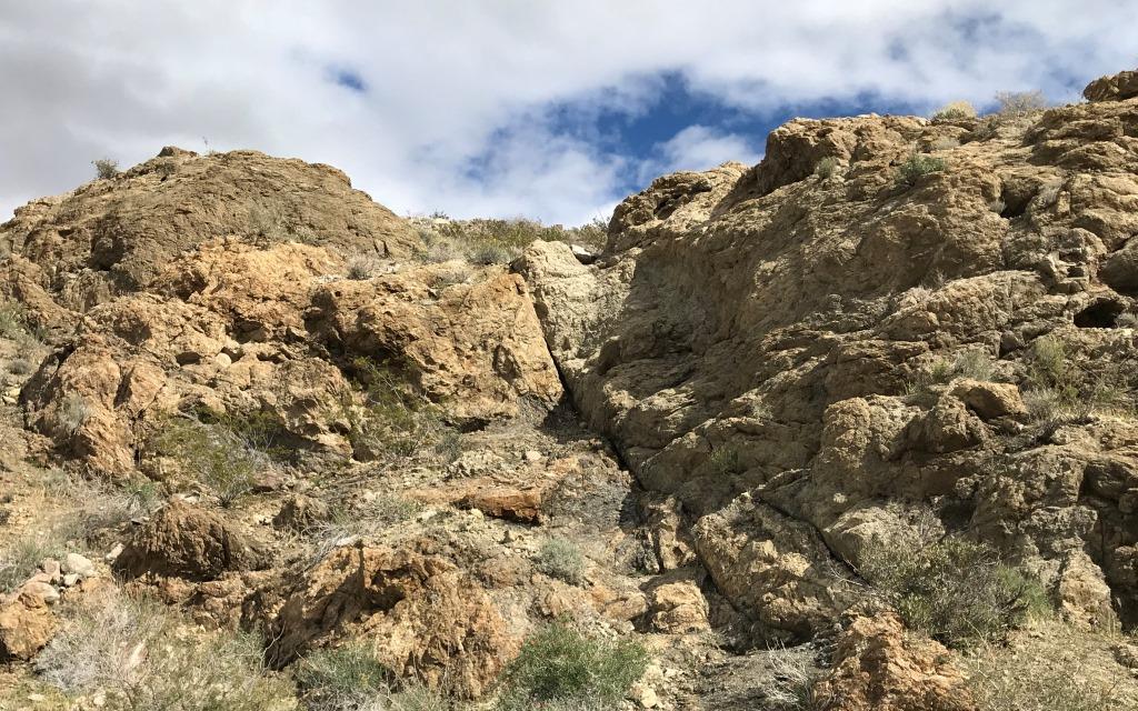
The first barrel cactus was close to the post numbered 3, which denoted an area with older, softer sedimentary rock next to younger, harder, granitic rock. Earthquake faults and their associated seismic activity caused these types of rocks to end up near each other, even though they have quite different ages. The removal of softer material by wind and rain resulted in the small cave-like holes. There is kind of a line of so-called holey rocks on this hillside, from the upper left to the lower right.
Holey rocks indicating juxtaposition of softer and harder rock
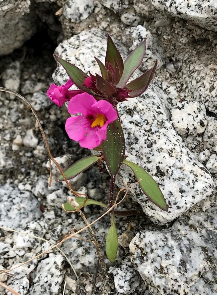
A few minutes later I noticed a small, solitary Bigelow’s monkeyflower (Diplacus bigelovii). The blossoms are about 1/2” across, and this plant was only about 1” tall. They are fairly common in desert washes and are found in the Southern California desert areas from Inyo and Kern Counties to the Mexican border.
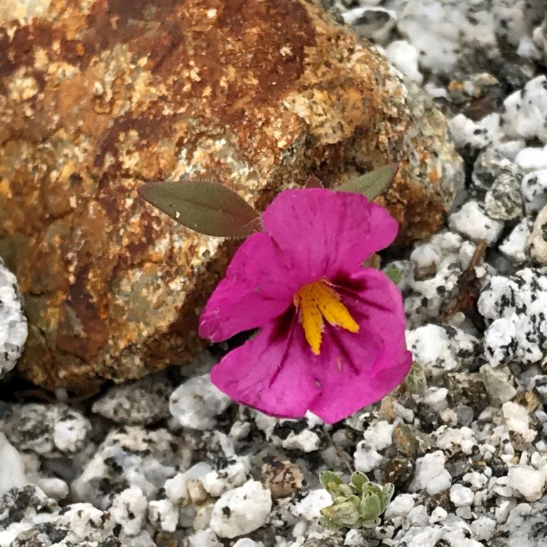
Bigelow’s monkeyflower
The next hillside was marked by another numbered post and a prominent crack, which was identified in the brochure as a fault – one of many in the seismically active area.
Easy-to-see fault
Frequently when I hike up washes I end up turning around at a dry fall – a waterfall without any water. In desert settings a dry fall can suddenly become a waterfall after a rain storm. Because of the recent rain there was a small puddle at the base of a small dry fall, and it was an easy decision to turn around rather than try to continue. However, I was glad I had not turned around sooner, because there was a pretty Arizona lupine (Lupinus arizonicus) plant. Arizona lupine is found in San Diego, Imperial, Riverside, and San Bernadino Counties and has more of a purple color than many other lupines.

Arizona lupine
The second barrel cactus pictured above was along the upper part of the wash. And so were a few other Bigelow’s monkeyflowers. These plants were taller, with more leaves along the stem and with multiple blossoms and/or buds at the top of the plant. I wondered if the size of the plant might be related to the amount of water, as it seemed likely that the plants farther up the wash, where there was a better-defined and narrow channel, would experience more moisture than plants in a wider area of the wash at lower elevation. This is kind of a speculation.
Bigelow’s monkeyflower
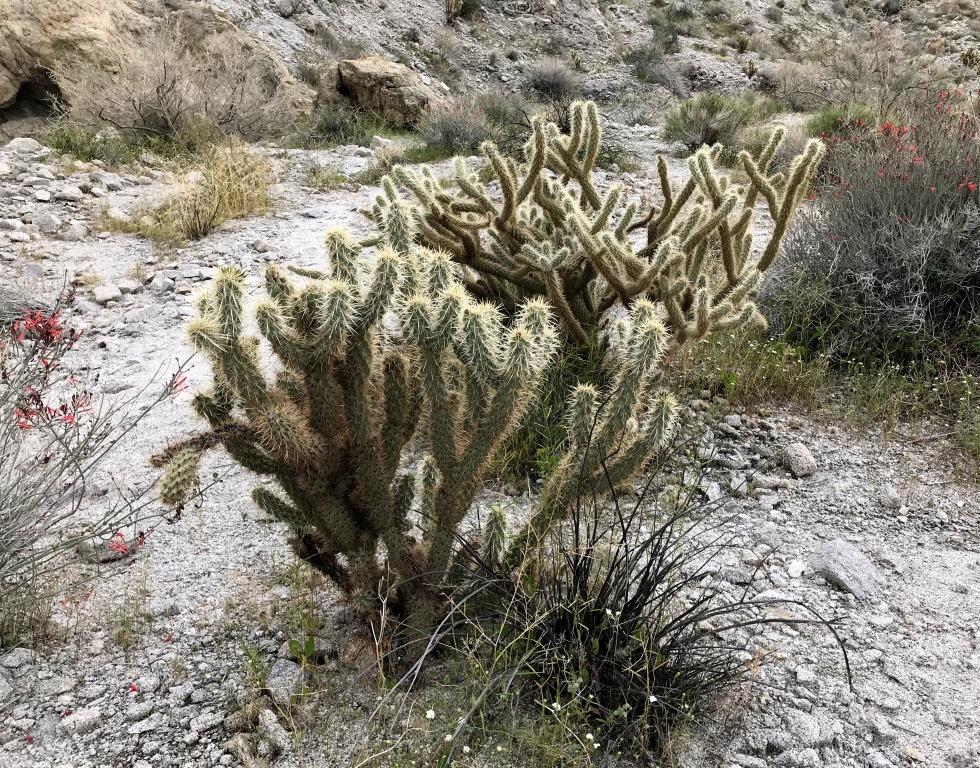
Soon, as I followed the trail down the wash, the return path diverged from the outbound path. In this area I found several cacti. First was a pencil cactus (Cylindropuntia ramosissima), which has distinct branches and spines. The branches are very skinny, resembling pencils, and the spines are rather long, a few times the branch diameter in length. Click on this picture to enlarge it and see the spines. Pencil cactus is found in the four main Southern California desert counties: San Diego, Imperial, Riverside, and San Bernadino.
Pencil cactus
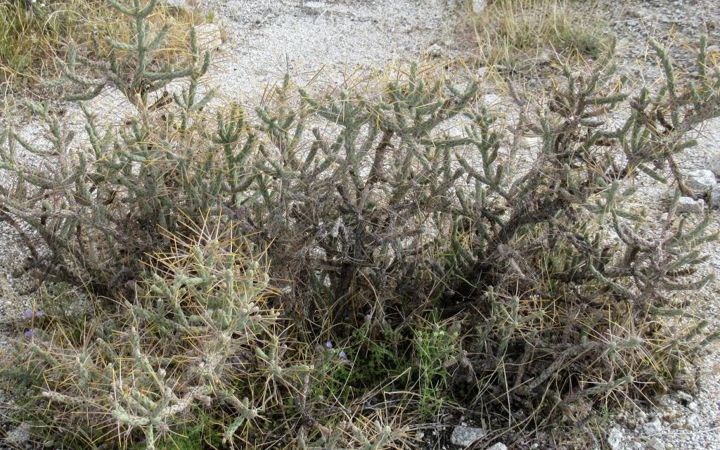
Nearby I found a pair of similar, but different, cacti growing next to each other. At first I thought the one in the back was another pencil cactus, but the spines are both shorter and more numerous. In addition, there is less branching at the tips of the branches. I am not sure of the identification, though it is certainly related (Cylindropuntia sp). The cactus in front is most likely Gander’s cholla (Cylindropuntia ganderi), which is one of the most prevalent cacti in Anza-Borrego Desert State Park. The branches have a larger diameter than the (possible) pencil cactus, and the spines are more prominent and numerous, especially at the tips of the branches. Gander’s cholla is found in San Diego and Riverside Counties.
Possible pencil cactus (back) and Gander’s cholla (front)
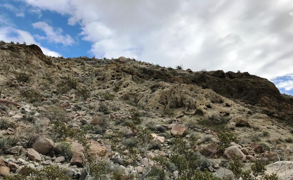
As I descended Powder Dump Wash I had a nice view of the informal trail through the desert chaparral and some dramatically side-illuminated clouds against an intense blue sky.
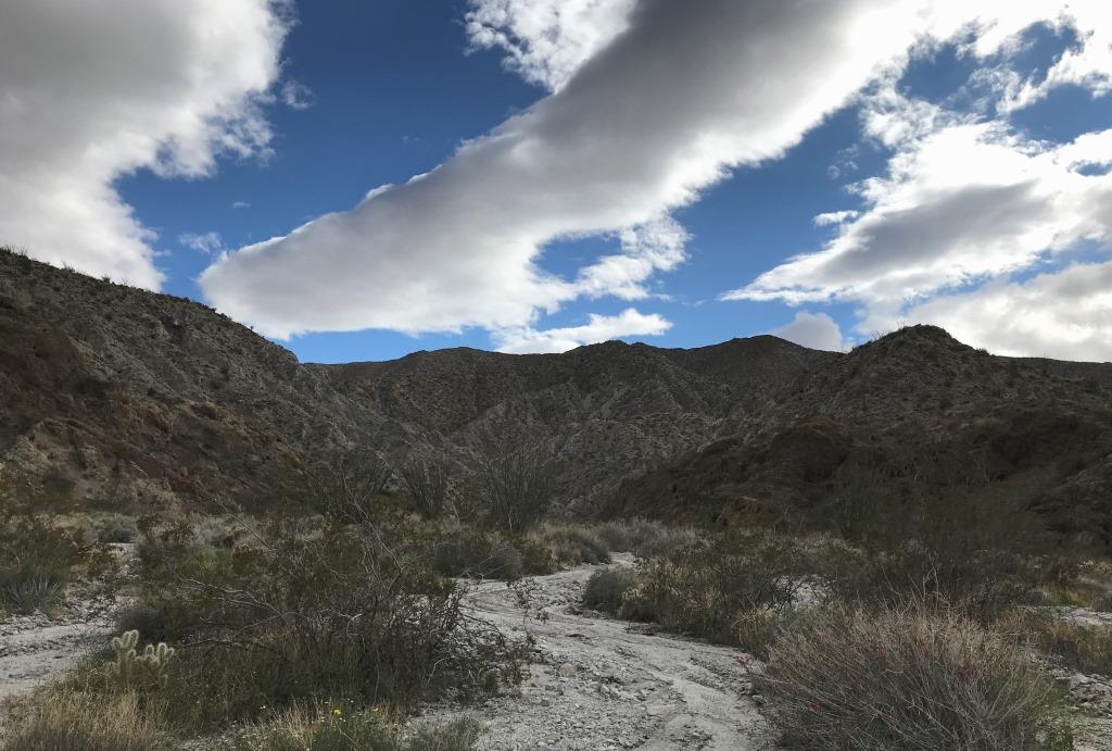
Powder Dump Wash
I passed one or two ocotillo (Fouquieria splendens) plants with just a few blooms. Then I found a desert agave (Agave deserti) with a spectacular spent flower stalk. The large, prominent bracts made the flower stalk look a bit like a giant asparagus stalk. Desert agaves, sometimes called century plants, may grow for up to 20 years before blooming once, dying, and then slowly decaying over a period of years. They are found in western San Diego and southern Riverside Counties.
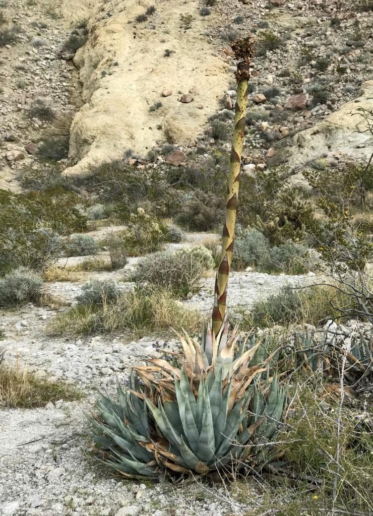
Desert agave
When I arrived back near the trailhead I stopped to look more carefully at some pretty phacelias that I’d seen several times along the trail. I believe they are common phacelias (Phacelia distans), one of the more common and widespread species among the approximately 47 phacelia species found in San Diego County.
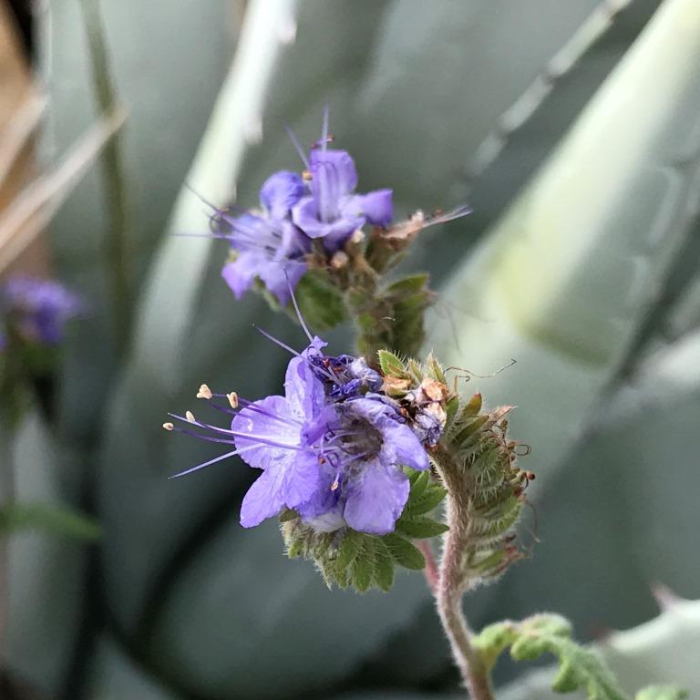
Common phacelia
This short hike turned out to be a nice combination geology and wildflower walk. When I finished I still had some more time, so I went to another nearby (perhaps 0.1 mile away) trailhead to explore Quartz Vein Wash.
