

During the second week of March – just before what turned out to be a critical period in all of our lives – I finalized my plans to take a short road trip to the southern California deserts to view some spring wildflowers. At the time I was primarily focused on the timing of upcoming total hip replacement surgery and secondarily on the emerging novel coronavirus crisis. With some effort I was able to stock up on a few cleaning items that I wanted to take with me and that were in increasingly scarce supply in stores, like wipes and paper towels, while cognizant that I’d need to be able to make do with the modest supply of hand sanitizer I had available.
In any case, I made motel reservations for 5 nights – 2 in Ocotillo Wells, 1 in Indio, and 2 in Twentynine Palms – and set out from home in the Bay Area with maps, guide books, wildflower books, and a rough plan. I was aware that there was a good chance for some rain in the southern desert area on my travel day, but hoped that that wouldn’t negatively affect the trip.
This turned into an interesting reminder about desert rain storms the next morning. My motel was not far from the Ocotillo Airport, a small San Diego County-owned aviation facility with two unpaved runways. The airport is located on a dry lake bed – that is, the lake bed is dry except after rain storms. This is a view from the local highway, CA-78. Sure enough, just as we learned in our childhoods, water collects in local low points, in this case the lake bed which was surrounded by a modest berm.
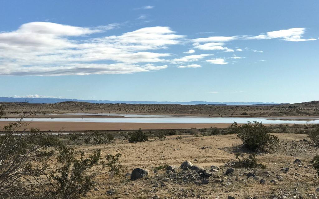
Ocotillo Airport after a rain storm
The desert air was clear, with views toward some of the mountains in Anza-Borrego Desert State Park which I would visit later that afternoon and the next day.
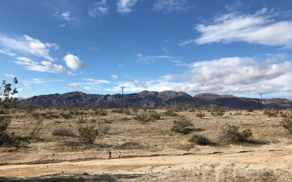
View across the desert toward Anza-Borrego Desert State Park
My objective for the day was to drive to the Algodones Dunes area in southeastern Imperial County, enjoy the dunes, and botanize. The Algodones Dunes area has two main sections, divided by CA-78, the same highway on which my motel was located. The north section is the North Algodones Dunes Wilderness, which is about 26,000 acres or 40 square miles in area. According to the web site, the designated Wilderness also includes the Imperial Sand Hills National Natural Landmark and the Algodones Outstanding Natural Area, though I didn’t find descriptions of these areas. The section south of CA-78 is the Imperial Sand Dunes Recreation Area, which is about 82,000 acres or 128 square miles in area. It extends to the Mexican border and is the largest sand dunes area open to off-highway vehicle use in the US. Because there are a number of plant and insect species that are endemic to the area, this situation has given rise to some tension between ecological and recreation use proponents.
I was hoping to visit the North Algodones Dunes Wilderness. Because of the wilderness designation there are roads only along two sides, and in order to visit it is necessary to park in one of three nearby parking areas and walk in. The parking area I was hoping to reach turned out to be inaccessible in my Prius, since it is located about 2 miles along a road that is more like a sand wash, reached by driving down a steep sand embankment. I was sure that, even if I reached the road, I would not be able to drive back up the embankment after my exploration. So I (wisely) abandoned my original plan and went to Plan B: I would go to an overlook, reachable by a short paved road, and explore from there.
The overlook is the Hugh Osborne Scenic Overlook, and it is just south of CA-78 about 4 miles west of the tiny town of Glamis. Though I did not realize it at the time, the overlook parking area is a legal access point for the North Algodones Dunes Wilderness, since one can park there, walk down the access road to CA-78, and cross the highway into the wilderness area. I decided to simply explore a smaller area of the dunes close to the parking area. I discovered that most of the parking spaces were occupied by ATV users, since the overlook is technically in the OVH recreation area.
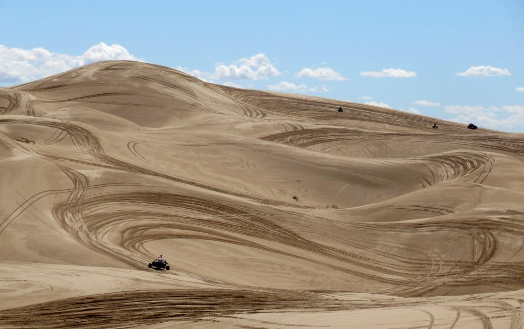
Looking roughly south, away from CA-78 and into the dune area, the myriad of ATV tracks dominate the landscape. On the one hand my first impression was disappointment about all of the tracks in this natural area. On the other hand, the Imperial Sand Dunes Recreation Area has been specifically set aside precisely for this use, and the area is owned and managed by the federal Bureau of Land Management (BLM).
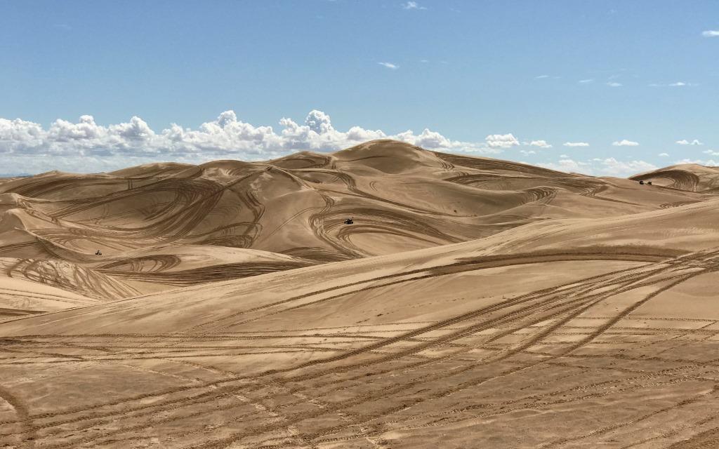
ATV tracks in the Imperial Sand Dunes Recreation Area
I parked in a Day Use parking spot and prepared to do a short hike. Basically I walked past a few large RV’s to the far end of the paved parking area and set out into the dunes, away from the busy ATV area. I made a small loop, just 0.6 mile and about 40 minutes total, as shown in this Google Earth image of my GPS track.
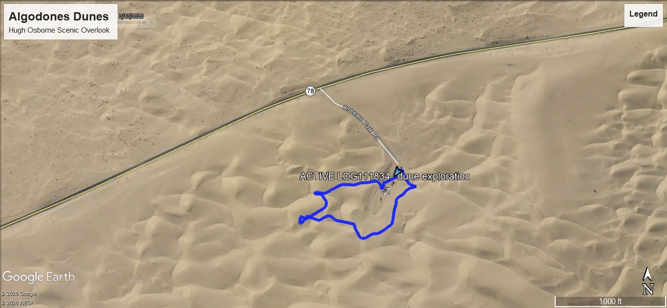
GPS track
The elevation profile shows the relatively modest elevation changes, about 160 feet total.
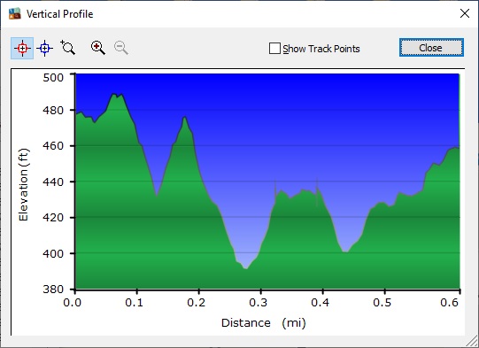
Elevation profile
First I headed for a nearby dune top, where I had a good view to the north, across CA-78 and into the North Algodones Dunes Wilderness. This turned out to be the highest elevation of my hike. The dark spots in the picture are plants, which seemed to be more prevalent in the Wilderness than in the Recreation Area.
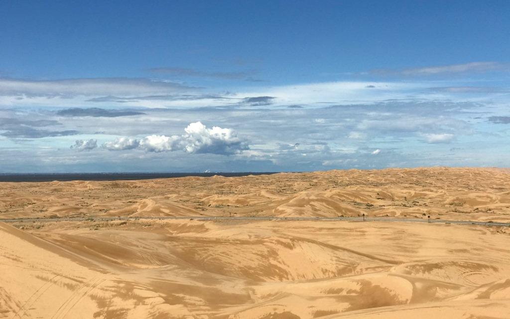
View across CA-78 into the North Algodones Dunes Wilderness
I continued generally straight ahead, west, to the next dune. Of course that meant going down the first dune, about 60 feet, and then up the next one, about 45 feet. And it should be clear from the pictures that the sand was very deep and fairly loose. Actually, because of the previous day’s rain, the sand was somewhat more firm than it sometimes is. In any case, once I reached the next dune top, which had an interesting curved shape, I decided to see if I could get my hiking poles to balance for a picture.
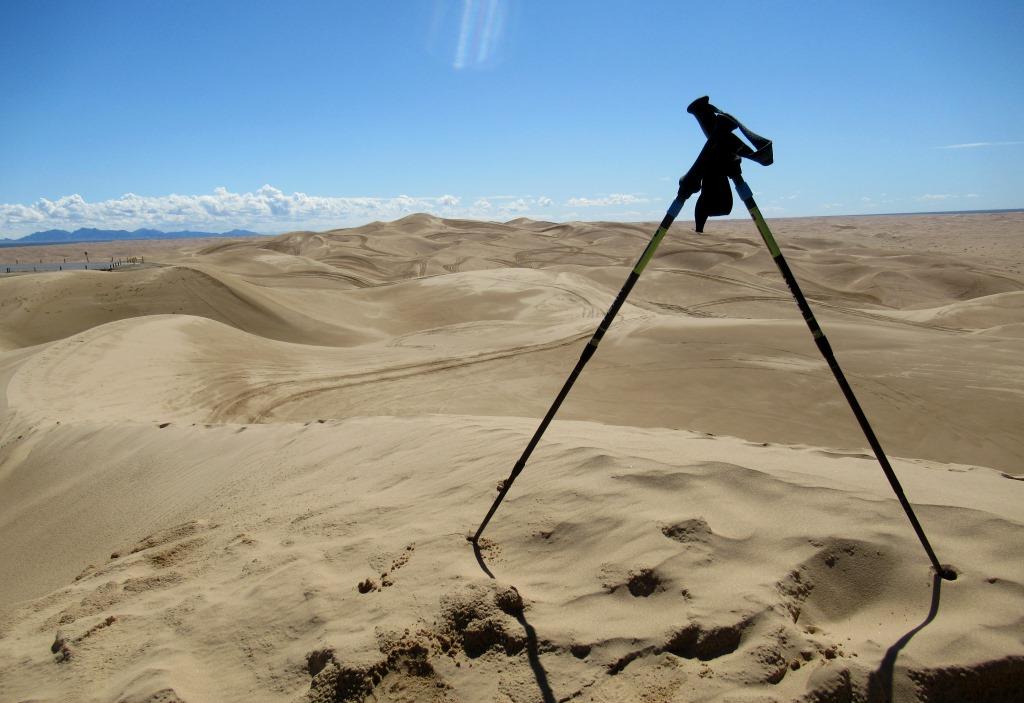
My hiking poles on a nice, curved dune top
I was the only person walking around in that area, and the only marks in the sand were my footsteps, my pole holes, and patterns made by the sand blowing in the breeze. This view was generally to the east, so the dark hills in the background are probably the Chocolate Mountains, where there is a huge US military gunnery range.
Next I went down the side of the dune to look at a couple of plants, which I was unable to identify. I climbed up high enough on the side of a dune so that I could kind of traverse for a bit. Then I had to go down in order to be in position to climb gradually back up to the parking area. As I was passing parallel to the parking lot pavement, but still out in the sand, I became a bit more aware of the buzzing of numerous ATV’s, and I noticed that I could see several at once, moving in and out of view, in front of or behind mini-dunes.
Dunes with several ATV’s buzzing around
This is an example of a couple of ATV’s that had been driven to the overlook parking area, perhaps to use the restroom. Many seem to be fancy, and they all sport fairly large flags on poles, for visibility in the dune landscape.

ATV’s at the Lookout parking area
I should note that, while driving out to the sandy road I decided not to explore, I had noticed quite a few desert plants and flowers along the sides of CA-78. The road was liberally posted with signs advising that there was no parking within 30 feet of the pavement. When I found essentially no plants on my hike, I decided I would go back along the road and simply pull way over on the shoulder in a few places, getting out of my car long enough to explore relatively briefly. I made all of my stops driving west, so technically I was on the Wilderness Area side of the highway when I got out of my car.
In any case, I found several interesting flowers. First was birdcage evening primrose (Oenothera deltoides deltoides), also called dune evening primrose. It is found primarily in the Southern California desert counties of Imperial, San Diego, Riverside, and San Bernadino. There were numerous clusters of them along the side of the highway. Even though the flowers bloom at night and then die the next day, I found plenty of fully-open flowers at mid-day.
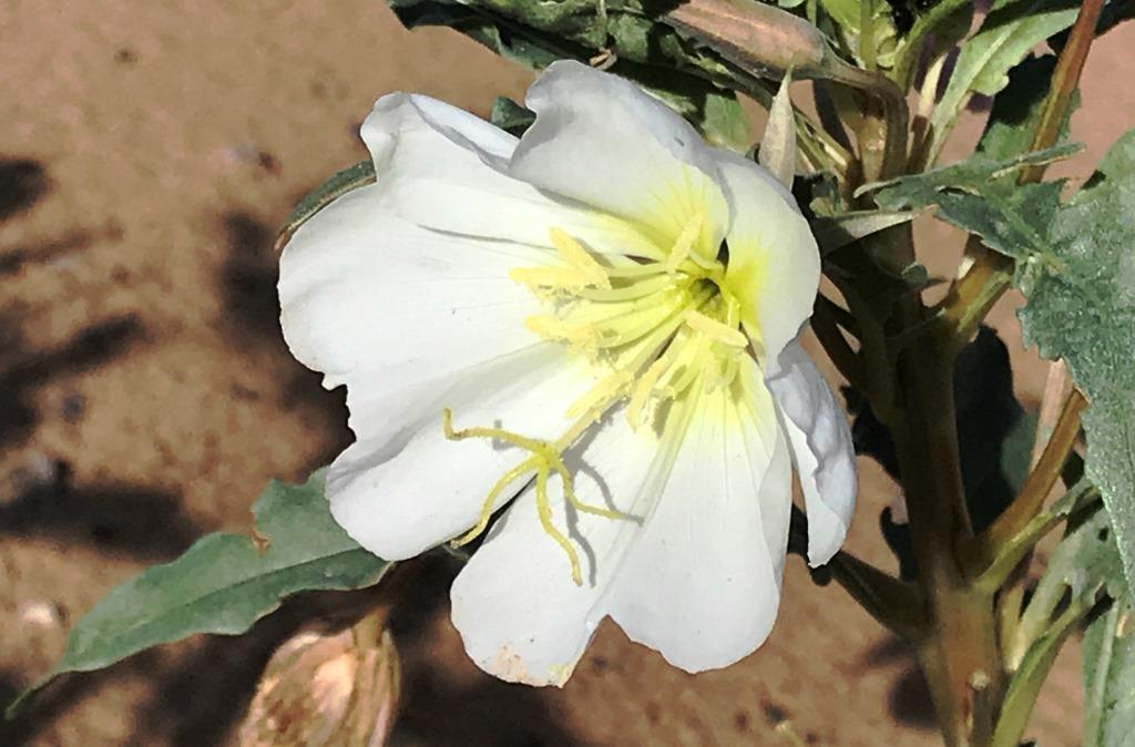
Birdcage evening primrose, or dune evening primrose
There were also numerous large clusters of desert sand verbena (Abronia villosa villosa), sometimes called hairy sand verbena. Within California its range is similar to that of birdcage evening primrose.
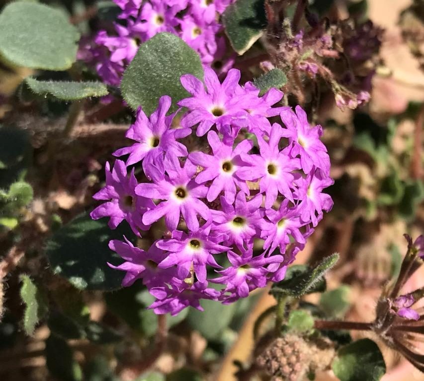
Desert sand verbena, or hairy sand verbena
Suddenly I noticed a butterfly, motionless on the ground. I stooped down to check it out, and determined that it was dead. It was a painted lady (Vanessa cardui). These pretty butterflies have an annual spring migration from Mexico and the southwestern US deserts to the Pacific Northwest. The migration takes a few months and requires up to a half dozen successive generations of butterfly. Females are said to reproduce virtually continuously. I hoped that this individual had been able to reproduce before dying!
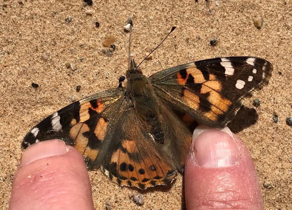
Painted lady butterfly next to the highway
At my next stopping point, just a short distance away, I found some giant Spanish needle (Palafoxia arida gigantea). In contrast to “normal” Spanish needle, the “giant” plants are much taller, generally waist-high or even up to 6 feet tall. These were closer to waist-high. Giant Spanish needle is considered to have a California Rare Plant rank of 1B.3 and is found only in the Algodones Dunes area.
Giant Spanish needle
Nearby I found some Algodones Dunes sunflower (Helianthus niveus tephrodes) plants with good populations of cheerful, recognizably sunflower blossoms. This plant has a California Rare Plant rank of 1B.2 and also is found only in the Algodones Dunes area. If you click on the picture to enlarge it, you can see that the disc flowers really do look like tiny individual flowers. I haven’t noticed that before for any type of sunflower, so I thought it was kind of neat.
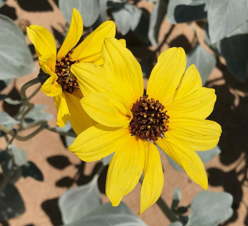
Algodones Dunes sunflower
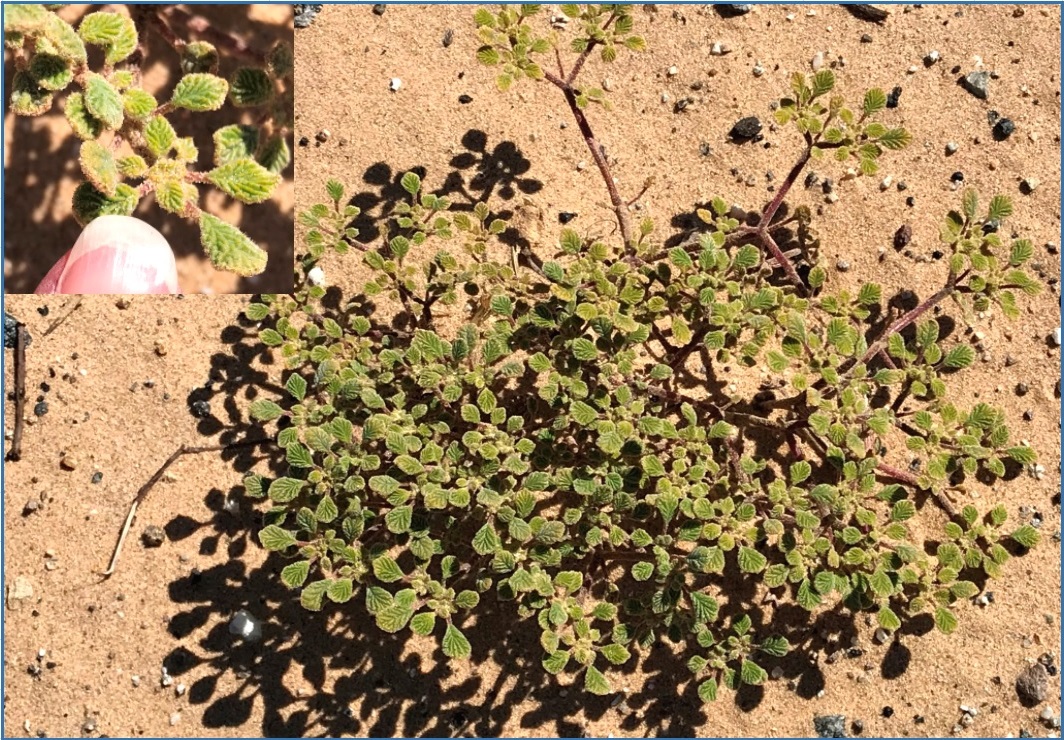
I then moved on to a different location a bit farther along the highway. I didn’t notice anything particular to stop for, but sometimes when botanizing – especially in a new or unfamiliar area – it can be rewarding to just stop periodically, get out of the car, and simply look around. Here I noticed a few low-growing plants, about 6” high and 2 feet across. When I looked more carefully I noticed tiny, delicate flowers with nearly translucent petals. Later I determined that it was cheesebush (Ambrosia salsola salsola). When mature, these bushes can be up to 3 feet high.
Cheesebush
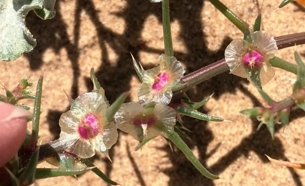
Nearby I investigated another low-growing plant, this one with small (less than 1/4” across), deeply grooved leaves. I didn’t notice any blossoms at the time, but my picture may show a couple. In the inset, my finger is about 1 cm, or 3/8”, across. I was unfamiliar with this plant, but was able to identify it later using the “What grows here?” feature on Calflora. It is fanleaf crinklemat (Tiquilia plicata), and it is found in the same four Southern California desert counties mentioned previously.
Fanleaf crinklemat
Continuing west on CA-78, when I reached another side road with a sign indicating a ranger station, I went in to see if it was staffed and, if so, if I could get some more information about the area. It was the Cahuilla Ranger Station, and the road leads further into the Recreation Area to several campgrounds. After chatting with a ranger and picking up some information, I parked my car and got out to explore once again, near the highway. I was excited to find a desert lily (Hesperocallis undulata), a favorite desert wildflower and another resident of the four Southern California desert counties. As it turned out, this was the only desert lily I saw in 4 days visiting the desert parks. The blossoms weren’t fully open, but that made it easier to see the characteristic green stripe on the outside of each petal and sepal.
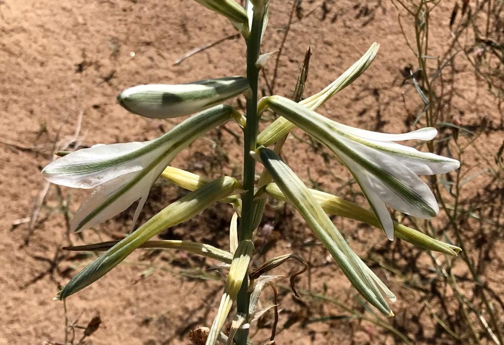
Desert lily
I drove farther and then pulled over one more time, when I noticed several bright yellow flowers. I thought they might be desert gold (Geraea canescence), or desert sunflower, and they were. I had first seen them a few years ago in Death Valley where, in a good rain year, they literally carpet the valley floor. Unlike many other sunflowers, the disc flowers are orange rather than brown. They are always a delightful find.
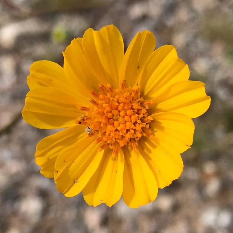
Desert gold, or desert sunflower
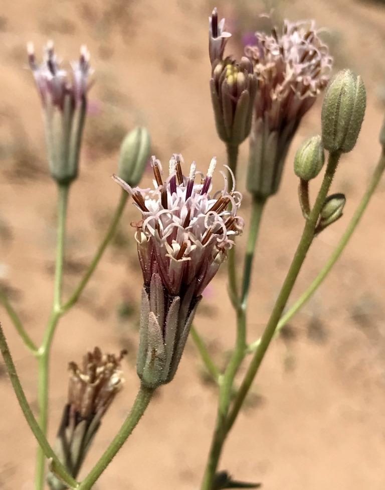
I also found some cryptantha (Cryptantha sp) plants with not-so-tightly coiled cymes and relatively few blossoms. I am not at all skilled in distinguishing between the many species of cryptantha, but I will note that narrow-leaved cryptantha (C angustifolia) is one of the more commonly observed species in Imperial County, and it is characterized by long hairs.
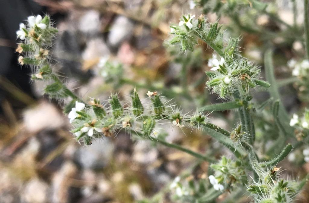
Cryptantha with striking, long hairs
After deciding that I’d stopped in enough places along the CA-78 highway – especially since parking wasn’t legal – I continued back toward Ocotillo Wells without further stopping and adventures. But since I’d spent much less time walking in the Algodones Dunes than I’d hoped to, I decided to continue west into Anza-Borrego Desert State Park to explore a couple of short self-guided nature trails, as described in a separate post.

Pingback: Anza-Borrego Desert State Park: Narrows Earth Trail | trailhiker