

This month I have been participating in the Santa Clara County Parks 2020 PixInParks Challenge, an annual program now in its fourth year. The program includes seven mostly easy-to-moderate hikes, each in a different county park. There is an effort to include a variety of different types of park experience, including some less-visited and some more-visited locations. The idea of the program is that people go for a pleasant outing in a park, take a picture or selfie at a designated location, and post the picture on social media with specific hashtags. It’s a nice way to get out and visit local parks for enjoyable outings. This year, due to a temporary issue that limits my walking, I have decided to do the shorter routes suggested for ADA visitors.
This post describes my sixth PixInParks hike for this year, at Los Gatos Creek County Park in Los Gatos. A significant part of the park, with picnic tables and other amenities, is on Dell Ave near San Tomas Expressway. The Los Gatos Creek Trail extends both north and south of this area for several miles in each direction along Los Gatos Creek and incorporates a paved multi-use trail along the creek and within what might be thought of as a strip park. The Los Gatos Creek Trail is a regional trail that connects Los Gatos, Campbell, and San Jose. The strip park is like a riparian oasis within these cities.
The heart of the park, on Dell Ave, includes 5 ponds with perimeter walking trails, as well as public facilities like casting ponds and a dog park. The ADA hike for PixInParks follows the pond perimeter trails around ponds 1-3, and the regular hike includes and additional out-and-back segment north along the Los Gatos Creek Trail. Although I have previously walked a long section of the Los Gatos Creek Trail, I had not previously visited the area around the ponds. The day of my visit was a nice spring day, and I was treated to a variety of views, spring wildflowers, and waterfowl.
As a kind of preview of my walk, almost as soon as I left the parking area I found a pretty patch of pampas grass (Cortaderia selloana). As with some other non-native plants, even ones that are considered invasive, I find it to be attractive to look at – possibly one reason it was imported in the first place.
Pampas grass
As mentioned above, my walk was primarily on the perimeter trails around three of the five ponds. I decided to use a Google Earth image of my GPS track because it shows details of the area, and clearly shows that the park really is a green oasis within its surroundings. My track is shown in blue, and the carat and “active log” label are in the parking area where I started and ended my walk. I intended to traverse a 3-lobed figure 8 pattern, but I found a fence closing off the left (west) side of pond #1 when I got there. After going around the ponds I extended my walk north past the casting ponds and dog park, almost to an underpass under San Tomas Expressway, where the Los Gatos Creek trail continues north to Campbell and San Jose. The total distance I walked was 2.5 miles, and there was virtually no elevation gain or loss.
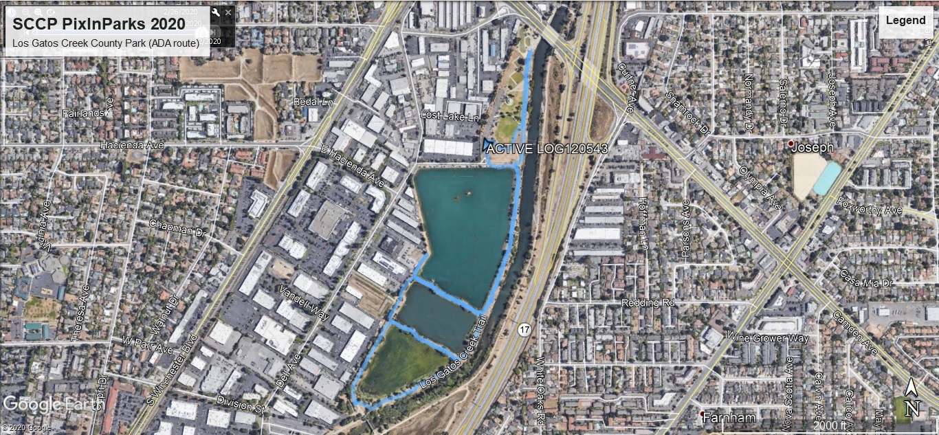
GPS track
From the parking area I walked over to the Los Gatos Creek Trail and headed south along the east side of pond #1. The paved trail is basically on a small levee between Los Gatos Creek and the ponds. Not far along the trail I encountered a Los Gatos Creek Trail mileage marker indicating 6 miles from the southern end near Lexington Reservoir.
In pond #1 I noticed American coots (Fulica americana) and Canada geese (Branta canadensis) near the trail. Farther away, closer to the south end of the pond, there was a flock of what appeared to be gulls. When I zoomed in with my camera, I was able to identify them as California gulls (Larus californicus). Distinguishing features included the markings on the yellow bills, the shade of grey of the plumage on the back, and the black-with-white-spots on the tips of the wings, clearly visible in this picture.
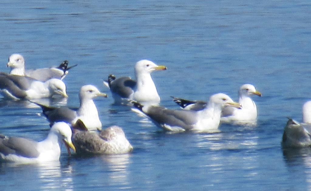
California gulls in pond #1 at Los Gatos Creek County Park
Before long I passed a nice patch of California poppies (Eschscholzia californica) between the trail and the creek. This picture shows, in shadow, the reproductive flower parts inside the cupped petals, as well as how the more mature plant looks after the petals have fallen off.
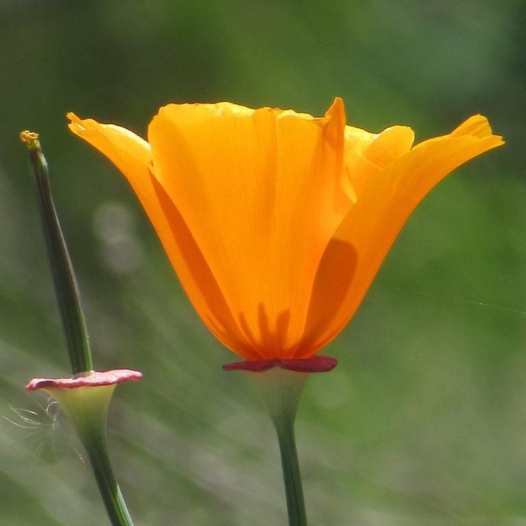
California poppy
When I got to the first side trail between ponds #1 and #2 I turned right to continue my intended figure-8 pattern. Near the corner there was a nice specimen of toyon (Heteromeles arbutifolia), a shrub with characteristic orange-red berries. A little farther along I passed some English plantain (Plantago lanceolata). Even though this is another non-native plant, I think the flower heads have an interesting appearance: the blossoms appear first at the bottom of the head, giving it an appearance reminiscent of a tutu.
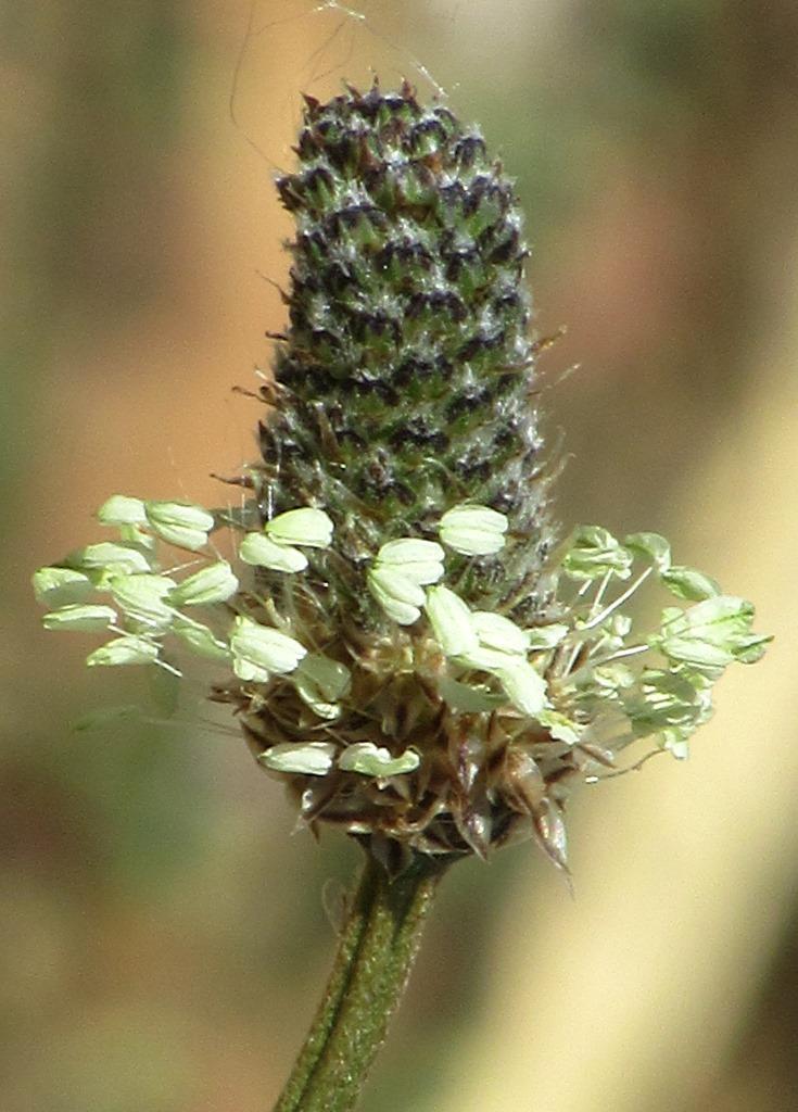
English plantain
Periodically there are concrete benches if visitor wish to sit down as part of their enjoyment of the park. Many of these benches incorporate interpretive signage provided by the Santa Clara Valley Water District explaining the Camden Groundwater Recharge Ponds and how they fit into the overall local water system.
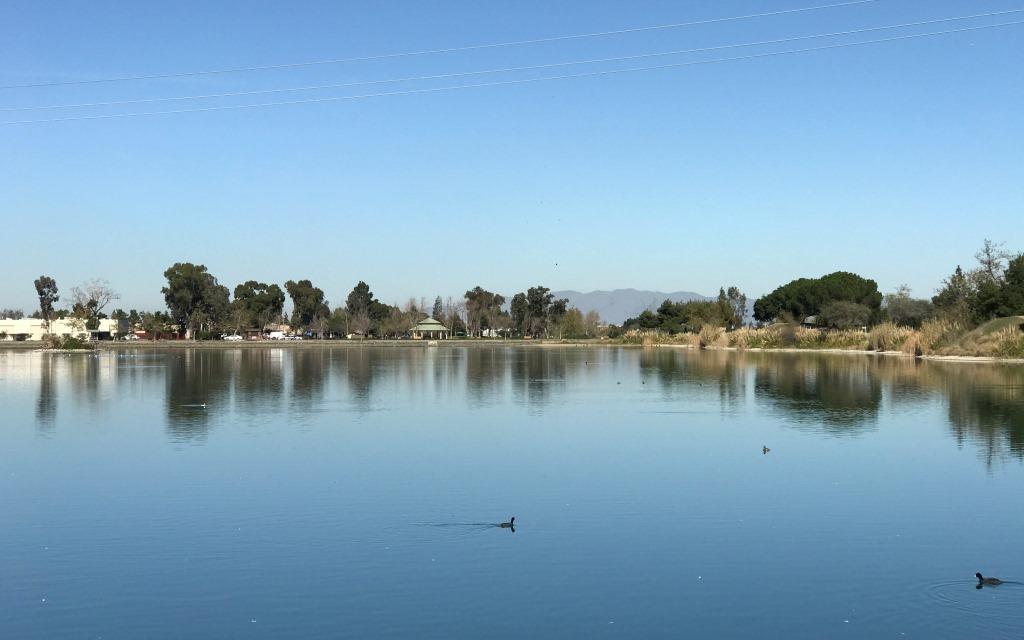
When I got to the trail between pond #2 and pond #3 I had a pretty view across the pond, with the Santa Cruz Mountains in the background. It is worth noting that ponds 3, 4, and 5 constitute a wildlife preserve, though I presume that the waterfowl don’t really make this distinction.
View across pond #3
When I got back to the paved trail I turned right to go around pond #3. In this area I found a pretty flower that I’ve been unable to identify, though I suspect it is non-native, possibly a garden escapee. Some of its light purple blossoms appear to have a second white flower in their centers. The red “accents” (either part of the base of the petal, or perhaps bracts) and bright green foliage added to a nice palette of colors.
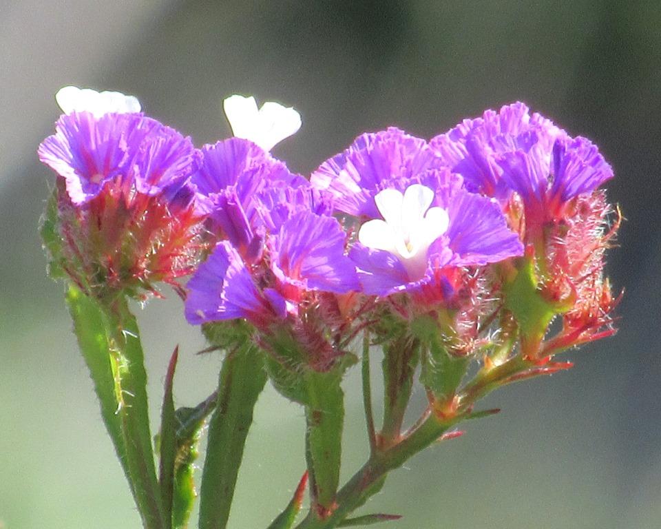
Unidentified purple flower
Nearby there was another non-native flower: Bermuda buttercup (Oxalis pes-caprae). This plant is quickly becoming invasive — it’s too bad, since the delicate green veins really look pretty against the bright yellow petals.
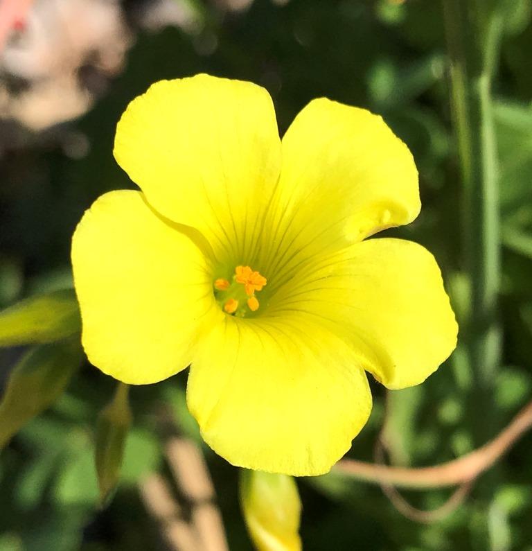
Bermuda buttercup
A little farther along I found some field marigold (Calendula arvensis), another attractive non-native. These plants often grow in masses that cover many square meters of area, or even a small field. The orange flowers are about 1 cm in diameter.
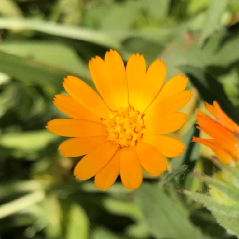
Field marigold
Near the field marigold there were some lupines (Lupinus sp), though I’m not sure of the species. This specimen was clearly in the beginning of its blooming phase, since there were numerous buds present for future blooms. Also, the accent color was white; in many lupines this will turn to a reddish-pink color after pollination, a visual cue to pollinators to go elsewhere. I enjoy finding wildflowers in various stages of development and bloom as the spring progresses.
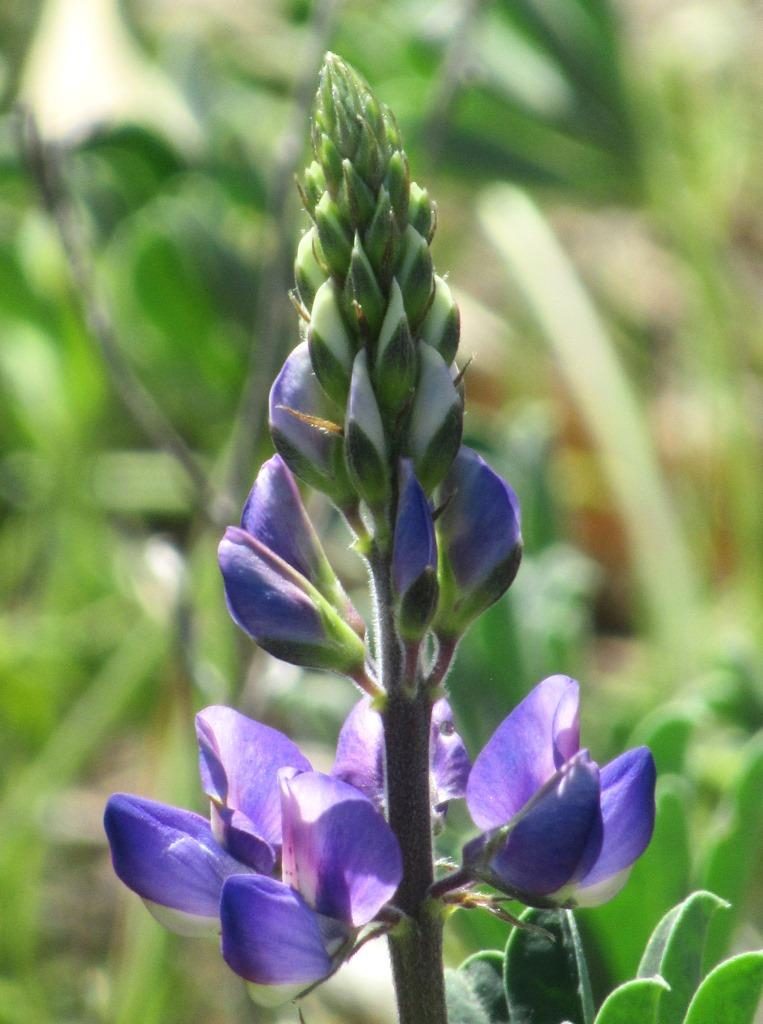
Lupine
When I reached the southern end of pond #3 I approached a beautiful western rosebud (Cercis occidentalis) shrub blooming nicely. This close-up shows two branches covered with delicate pink blossoms.
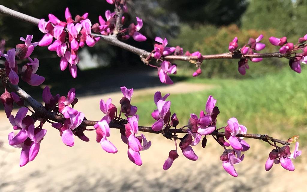
Western rosebud at the south end of pond #3
After completing my circumnavigation of pond #3 I walked a second time along the trail separating ponds #2 and #3. I noticed several ducks in the water and took some pictures for later study and identification. Included were some ring-necked ducks (Aythya collaris). I find this to be an interesting common name, since the most distinguishing characteristic is a ring around the (blue) bill, not the neck. The picture shows a pair.
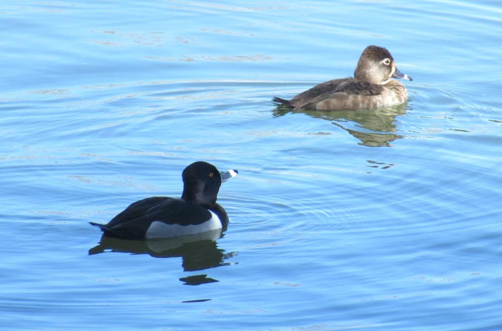
Ring-necked ducks
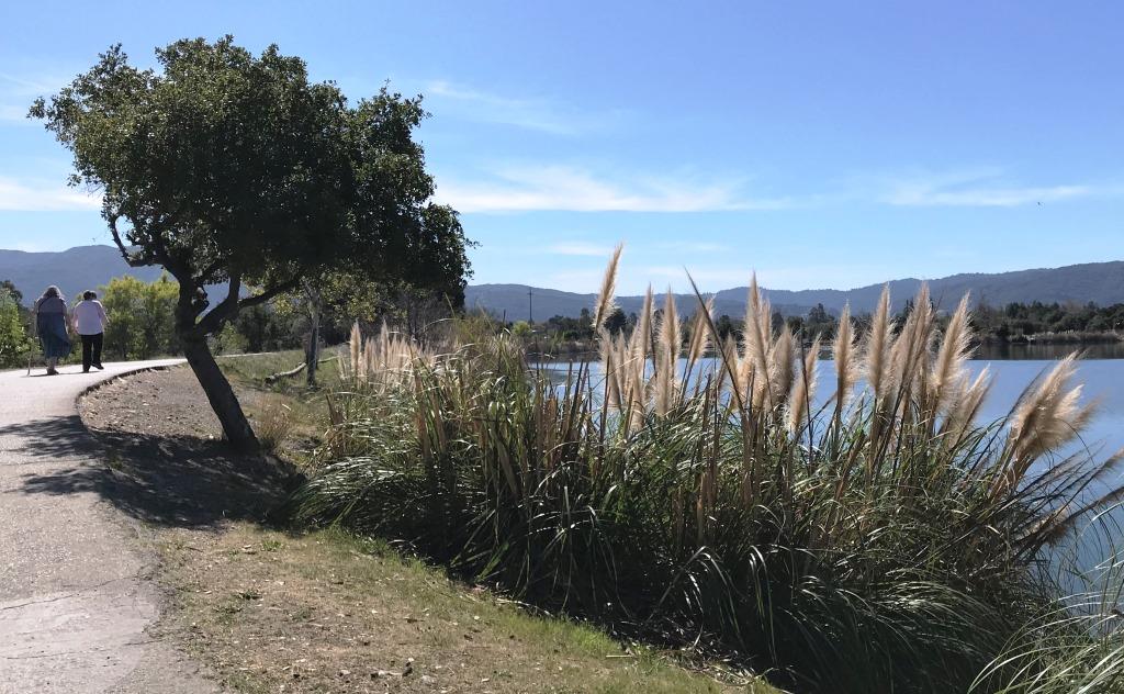
As I approached the paved Los Gatos Creek Trail a group of people walked by, possibly on a lunch break and enjoying some two-by-two chatting. (Note: this was before social distancing measures were announced in the Bay Area!)
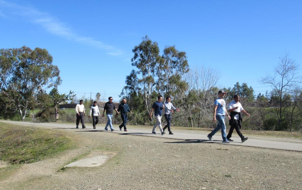
Trail visitors possibly enjoying a lunch break
When I reached the trail junction I was somewhat more aware of the traffic on nearby CA-17 barely a stone’s throw away, and I noticed signage for a nearby exit. It was another reminder that the park is located literally in the midst of an urban area.
At the edge of the nearby pond there was a pair of mallards (Anas platyrhynchos). The male appeared to be preening, but momentarily walked into the water and swam near his mate. The blue wing patch, shiny green head, and narrow white neck ring band are easy to see in this picture.
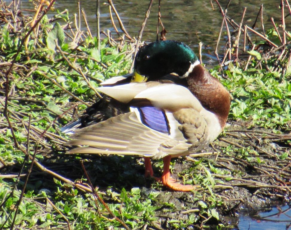
Male mallard
When I got to the next side trail I walked between ponds #1 and #2. There was a pretty view to the north across pond #1 toward the parking area where I’d started. I think the green-roofed structure is a shelter for one of the picnic tables adjacent to the parking area. The reflections are peaceful, and there is a partial view of the Diablo Range, in the East Bay, in the background.
View across pond #1
At the end of the short cross-trail I reached, for the second time, the location for the PixInParks photo. There is a short pier that might normally be usable for fishing, which is allowed in pond #1. I’m not sure why the cone was in place, but I didn’t walk out to check out the view. As is my habit, since I’d gone on my hike alone I placed my daypack in the picture instead of trying to take a selfie.
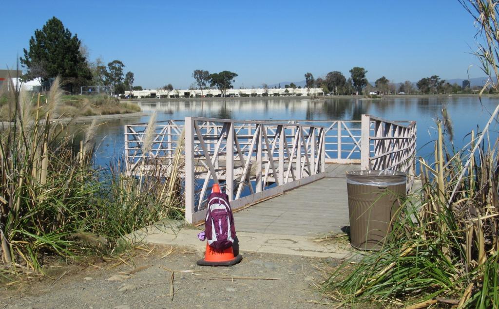
PixInParks photo for Los Gatos Creek County Park (ADA route)
From the PixInParks location I attempted to walk around pond #1 on the west side, but I soon found a fence and signage blocking the way. The park maps appear to show a trail going through, but apparently it is not open to park visitors. In any case, I turned around and walked back – for a third time – on the short trail between pond #1 and pond #2. On my way I noticed a western grebe (Aechmophorus occidentalis) floating in the water. The red eye and black cap extending below the eye are distinctive for this species. Also, I enjoyed its reflection on the water’s surface.
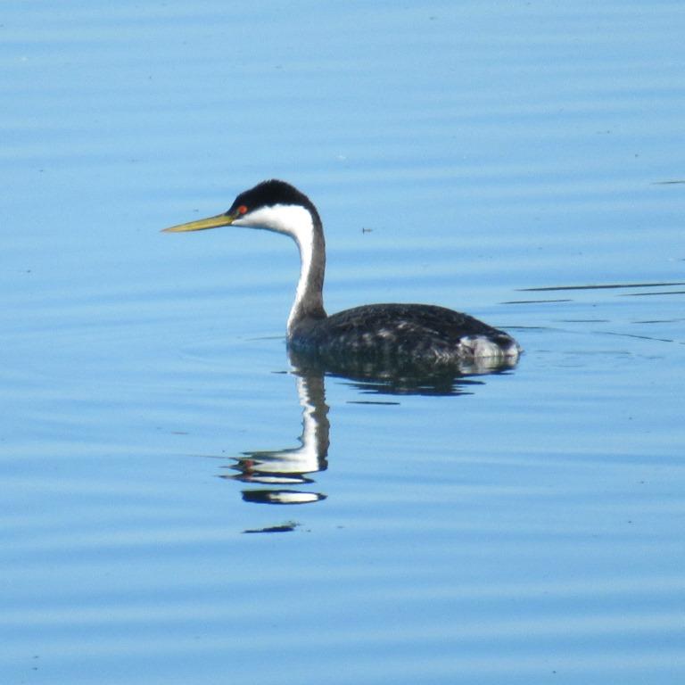
Western grebe
When I got back to the trail junction near the parking area I decided to continue north for a short distance. Since I hadn’t studied the park’s amenities in advance, I was a bit surprised to find the casting ponds just past the picnic area. I presume the concentric rings are basically targets, and users can decide which target(s) they want to practice on. It was interesting to just stand and watch for a few minutes. I took a few pictures and was lucky to get one with this man’s fishing line in mid-air.
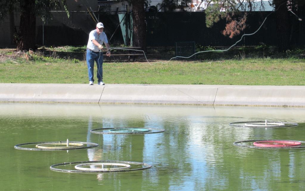
Casting pond in Los Gatos Creek County Park
Past the casting pond area there is an enclosed dog park. And then the Los Gatos Creek Trail goes under the San Tomas Expressway overcrossing of Los Gatos Creek. I decided to turn around where the trail heads down the embankment for the undercrossing.
On my way back to the parking area I noticed some scarlet pimpernel (Lysimachia arvensis) in the grassy lawn of the picnic area. This is yet another non-native flower, but a very attractive one. The purple colors at the base of the petals help guide pollinators to where they are needed.
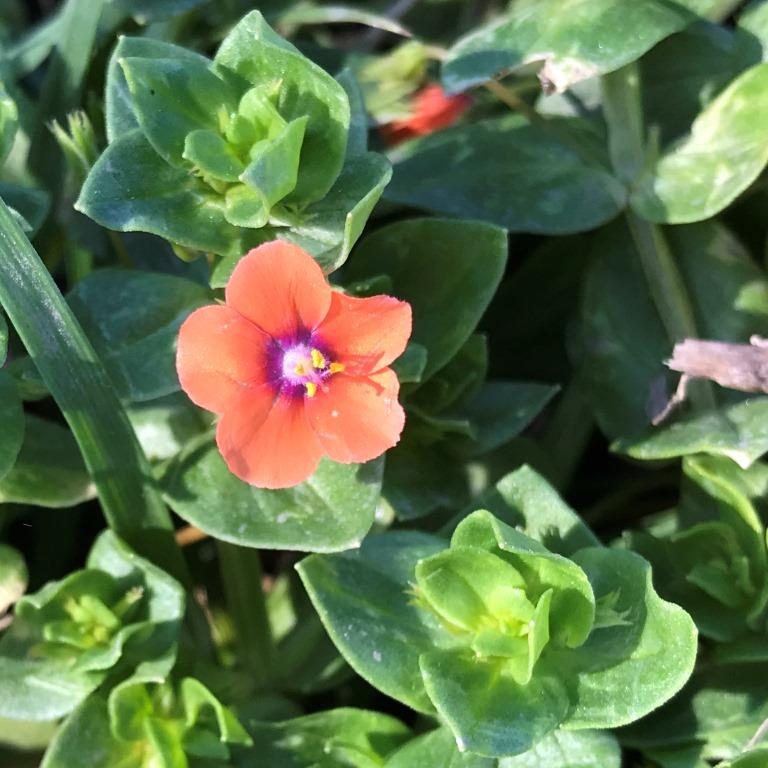
Scarlet pimpernel
Eventually I reached my car and ended my walk. It had been a very pleasant visit to a park I’d not previously visited: exactly what the PixInParks Challenge intends to encourage.
