

Hidden Villa is a 1600-acre open space gem in the Los Altos Hills foothills. It was founded by the Duvenick family and is operated by a nonprofit educational organization focused on organic farming and other sustainable practices. There are about 8 miles of trails in the preserve, with connections to Rancho San Antonio Open Space Preserve and beyond. Although I’d driven past the main entrance many times, this was my first visit, suggested by a friend after a recent hike. It turned out to be a wonderful wildflower hike, passing through moist woodland and higher-elevation chaparral and open areas and with several new wildflower finds (for me). There were also pretty views over the San Francisco Bay and farther into the Santa Cruz Mountain foothills.
I hiked a figure 8 pattern starting from the main entrance, denoted by the orange dot at the top of the GPS track. The total distance was 6 miles, including a little bit of off-trail exploration on Ewing Hill.

GPS track
The trail leading from the entrance goes along Adobe Creek past a hostel, then curves and crosses the creek. Associated with the educational farming aspect, there is a display of old farm equipment.

Farm equipment on display
I was planning to hike the Long Bunny Loop Trail; I intended to go counterclockwise but missed a sign and ended up going clockwise. This loop accesses the Middle and West Forks of Adobe Creek as well as Bunny Creek, and climbs 500 feet up the hillside and back down. The ascent was fairly steep, with a 13% grade.

Elevation profile
I saw a multitude of wildflowers along the Long Bunny Loop Trail (there is a shorter loop, called the Short Bunny Loop). One of the first flowers I saw was the starflower (Trientalis latifolia), and it was quite abundant along the creeks. After a bit I noticed that some of the flowers looked a little different, then determined that they had different numbers of petals. Altogether I noticed specimens with 6, 7, 8, and 9 petals!

Starflowers with different numbers of petals
There was miner’s lettuce as well as ferns and numerous fairy lanterns, or white globe lilies (Calochortus albus).

Fairy lanterns along the Long Bunny Loop
In addition there were quite a few Fernald’s irises (Iris fernaldii). These pretty flowers are supposed to be pale-colored, but this one’s delicate purple veins were especially prominent.

Fernald’s iris
A bit higher there was yellow sticky monkeyflower, golden yarrow, and some bugle hedgenettle (Stachys ajugoides rigida), also called common rigid hedgenettle. The flowers look like little bugles and have a touch of delicate spotted coloring.

Bugle hedgenettle
In a spot that happened to have sunshine when I came by I noticed hairy honeysuckle (Lonicera hispidula). I think I have seen this before elsewhere, but this time I was able to get a good photo that showed the distinctive stamens and aided identification.

Hairy honeysuckle
The upper portion of the Long Bunny Loop achieves high enough elevation that there is a section of chaparral, where I saw the first of many pipestems (Clematis lasiantha). I would see lots more later during the hike. The “hairy balls,” as I used to call them before I figured out the actual name, are what develops after the more traditional blossom phase has completed. It was by serendipity that I found photos on-line that elucidated this identification, even though the balls/heads are very distinctive.

Pipestem
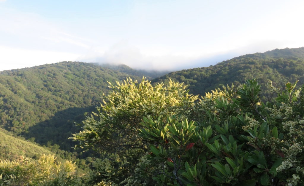
Brief breaks in the chaparral afforded pretty views across San Francisco Bay to the East Bay hills. The peak in the center of the skyline is Mission Peak.

East Bay skyline from Long Bunny Loop Trail
The descent was a bit less steep, more like 10% grade. Along the way, again in a creek-side area, I passed some beautiful crimson columbine (Aquilegia formosa).

Crimson columbine
There were a few fallen trees with interesting fungus and moss growing on the rough ends of trunk sections.

Fungus on a fallen tree
In this section of the trail there was a variety of wildflowers including woodland stars, paintbrush, California wild rose, Solomon’s seal, and California blackberry. After about 2.2 miles I came to the end of the Long Bunny Loop Trail and retraced my path along Adobe Creek for about 0.2 mile, continuing along the Creek Trail until it became Ewing Hill Trail (another 0.9 mile farther on). Blue dicks, yarrow, morning glory, grassy tarweed, and other wildflowers were along the way as the trail climbed gently along the East Fork of Adobe Creek.
A trail sign indicates the beginning of Ewing Hill Trail, and the grade suddenly becomes steeper (at 3.3 miles on the elevation profile). Near here there were some white blue-eyed Mary (Collinsia bartsiifolia), and the trail leaves the creek and emerges into chaparral. As the trail climbed there were more golden yarrow, pipestem, and paintbrush, as well as silver puffs and views up into the higher foothills.
About 0.7 miles up Ewing Hill Trail, 4.0 miles from the beginning of the hike, the trail reaches a crest on the shoulder of Ewing Hill at about 1200 feet elevation. In this area there are a few social trails, which turned out to be a little confusing. Also, the trail passes from Hidden Villa property into Ranch San Antonio Open Space Preserve. Where the trail passes a sign indicating No Bikes down Ewing Hill Trail, you are actually supposed to go to the right for about 0.1 mile to arrive at a T intersection with Black Mountain Trail.
Instead I explored the social trails a bit, passing owl’s clover and a pretty, backlit Ithuriel’s spear (Triteleia laxa). The lighting accentuated the vein structure in the blossoms.

Backlit Ithuriel’s spear
In this area I also found several yellow mariposa lilies (Calochortus luteus).

Yellow mariposa lily on Ewing Hill
After my exploration I continued to the junction with Black Mountain Trail and turned left for about 0.2 mile before taking the marked trail back into Hidden Villa. I had hiked on Black Mountain Trail previously, hiking from the lower part of Rancho San Antonio Open Space Preserve to the top of Black Mountain. Along this section of trail I found some blue larkspur and an unusual-looking plant that I’m pretty sure is a type of pincushion plant (Navarrietia), with small blossoms on longish wavy stems above a spiky, pincushion-like ball.

Pincushion plant
There were also mule’s ears, buckeye, and other plants that thrive in a chaparral environment. Along the Hidden Villa access trail I passed some dramatically orange wind poppies (Stylomecon heterophylla).

Wind poppy
There were intermittent views of San Francisco Bay. Once the trail re-enters Hidden Villa it is designated Hostel Trail and rolls up and down a bit as it approaches Elephant Mountain. I noticed some rather tall spikes with delicate small pink-white flowers, later determined to be pale-flowered western larkspur (Delphinium hesperium ssp. pallescens). The flowers’ larkspur-like shape helped me with the identification.

Delicate pale-flowered western larkspur
The final high-point of the trail, at about 1130 feet, was about 5.1 miles from the start and on Elephant Mountain. From this vantage point I could see fog drifting over the hills near Black Mountain.
Afternoon fog drifting over the hills
In a different direction, some of the nearby hills are rather dramatic, possibly in Palo Alto Foothills Park or Los Trancos Open Space Preserve.

View of nearby hills
After passing these lovely views Hostel Trail continues down the hillside and becomes fairly steep. Along the way I found a bush of bluewitch (Solanum umbelliferum). The flowers tend to close at night, and these were getting ready to close.

Bluewitch along Hostel Trail
The first part of the descent from Elephant Mountain down to about 700 feet elevation has a grade of about 13.5%, but below 700 feet the grade steepens to 20%. The trail is also quite narrow, so a lot of care is required to descend safely. As it happens, I tripped and scraped a couple of knuckles. I also managed to pick up a tick, which I discovered after I got home. Since it was still alive after I pulled it off of me, I decided to have it tested; fortunately it was not infected with Lyme disease.
After reaching the base of Hostel Trail it was a short 0.1 mile back to my car. In spite of my late-hike adventure it was overall a very enjoyable hike, with many wildflower sightings including several that were new for me.

Thanks for helping me identify Pipestem Clematis in my own photos. Also, I hike here often and am always amused that Elephant Mountain is smaller than Ewing Hill.
HI, how are you? 😊
We are going on a long hike this weekend encompassing Rancho SA (part of) and Hidden Villa. The plan is to hike down the Ewing Hill Trail, but due to steepness, do you think it would be easier to hike it up instead of down? I do not like to go down on steep trails with lots of loose rocks on the surface, I’d rather take those trails on the way up.
Thanks for your help, happy trails!
CL
Sorry for a late response. I, too, tend to prefer a steeper uphill rather than downhill. I’ve taken a few falls while hiking and I think they have all been going downhill! My biggest mistake is to rush, so my best advice is to take your time going downhill, especially if it’s steep. Also, it’s going to be warm this weekend, so prepare with hat, sunscreen, and more water than you think you’ll need. Hope you have fun!
Thank you so much! Our hike was wonderful last Sat! We parked at Westwind Barn and walked to Rhus Ridge Rd which is Rancho SA. Up the road we went, and at the top we went right onto Black Mountain Trail until the second junction with Hidden Villa, which is Ewing Hill Trail. The going down was made easier by several switchbacks, so the trail didn’t feel steep at all. At the bottom of Adobe Creek Canyon, we walked creekside and at the end of Creek Trail hopped on the Short Bunny Loop. I liked this single track but the name could be misleading. It is a wisp of a trail, severely eroded in place, no more than 8 inches wide, with a significant drop off. Cute, but it demands attention! We then passed by HV farm and walked from there back to Westwind Barn and our car.
Thanks for an awesome blog, I have been following you for years. Take care,
CL
Great that you enjoyed your hike!
Pingback: Rancho San Antonio Open Space Preserve to Black Mountain | trailhiker