In Sonoma County, north of the town of Sonoma is a region known as the Valley of the Moon, through which CA 12 runs. Within a radius of less than 10 miles there are several parks containing segments of the Bay Area Ridge Trail: Jack London State Historic Park, Annadel State Park, Hood Mountain Regional Park, and Sugarloaf Ridge State Park. This segment is in Sugarloaf Ridge State Park and it was my first hike in this area.
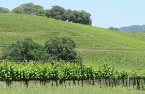
The drive to and from the park passes numerous vineyards, which are interesting any time of the year but even more so during the growing season.
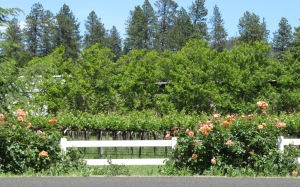
Some of the vineyards have colorful flowers along the highway, which make them even more beautiful and distinctive.
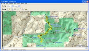
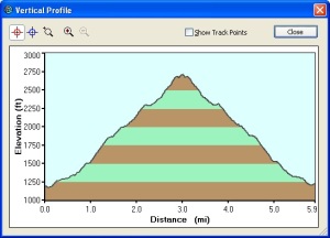
The day of my hike was warm, and the trail climbs steadily from around 1200 feet elevation at the Visitor’s Center trail head to about 2730 feet elevation on top of Bald Mountain, which is practically on the Sonoma – Napa County line.
A lower portion of the trail is a paved road for service vehicle access to a microwave station on nearby Red Mountain, and the entire trail up to Bald Mountain is very hard packed and about 1 vehicle wide. Because of the grade I was using my hiking poles, and I was vaguely aware that I was making a tap-tap sound as I walked. Suddenly I heard a hiss, or more likely a rattle, behind me. When I turned around to look for what had made the sound, I saw a snake perhaps 7-10 yards back down the road and only a couple of feet off the pavement. I could see that the body was coiled, the head was raised, and the snake’s forked tongue was flashing in and out of its mouth. I surmised that I had startled it, and that it was not particularly happy. Faced with a choice of immediately returning to the trail head, which meant walking right past the snake, or continuing up the trail, I decided that the latter was the safer option. After this I stayed carefully to the center of the trail!
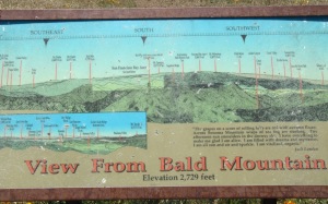
At the end of the trail on top of Bald Mountain there is a nice 360 degree view of the surrounding area. Two informational signs identify various landmarks.
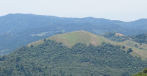
One of the more distinctive landmarks is Little Bald Mountain. It’s easy to see how it got its name. (Bald Mountain, on the other hand, is not as bald.)
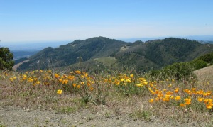
Near the summit there were abundant poppies along the side of the trail.
During my return hike I continued to look carefully for snakes, and I’m happy to note that I didn’t see any others. I resolved, however, to be very careful to constantly check the area near my feet and avoid single-track trails through tall native grasses, especially in warm weather.


Pingback: Annadel State Park – west end | trailhiker
Pingback: Hood Mountain Regional Park | trailhiker
Pingback: Hood Mountain Regional Park | trailhiker
Pingback: Annadel State Park – west end | trailhiker